Linné boulders paper published!
Paper
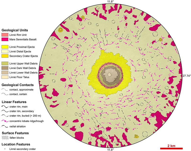
The first study on the size-frequency distribution (SFD) of the ejected boulders surrounding the Linné crater (Moon) has been published by PlanMap consortium members and affiliated researchers. Through the use of the Lunar Reconnaissance Orbiter Camera images, the team has prepared the first high-resolution geological map of the studied area, located in northwestern Mare Serenitatis.
By exploiting both the geological map and the boulder surface densities, the team identified that Linné’s proximal ejecta blanket is slightly asymmetrical in the NE-SW direction. This can be either the result of an oblique impact emplacement of the original impactor, or the result of a perpendicular impact on a surface characterised by basalts with different local mechanical properties. The boulders statistics also permitted to estimate the corresponding regolith thickness of the Linné impact site (~4.75 m), supporting previously indicated values with an independent methodology.
The article is available Open Access on arXiv at: https://arxiv.org/abs/1812.00590
For more information, Please contact Maurizio Pajola.
 This project receives funding from the European Union Horizon 2020 research and innovation program under grant agreement N. 776276.